-
-
Sort through our administrative resume examples to see what works best for you.
-
Our sales resume examples can help you write the best possible resume.
-
Explore our food service resume examples to show your skills effectively.
-
Start crafting your job-winning resume with our teaching resume examples.
-
-
-
Use our administrative cover letter examples for ideas on writing your own.
-
Use our sales cover letter examples to effectively show your sales accumen.
-
Write your job-winning cover letter following our nursing cover letter examples.
-
Learn to tell your story in education using our teaching cover letter examples.
-


- Our customers have been hired by*

Entry-Level Data Systems Administration Resume
This resume example effectively showcases the transferable skills and relevant accomplishments of career changers, making it an ideal choice for those entering the data systems administration field.
Why this resume works:
A skills-focused resume format is perfect for those new to data systems administration or transitioning careers. It highlights key strengths like system analysis, database management, and network security, rather than focusing on employment gaps. This approach showcases critical technical skills necessary for success in the field.

Mid-Career Data Systems Administration Resume
This resume example is perfect for data systems administrators with experience looking to elevate their careers through specialized roles or advanced responsibilities in the field.
Why this resume works:
Mid-career data systems administrators can highlight achievements such as improving system efficiency by 30% through innovative solutions or reducing database errors by 50% via new audit protocols. They might also note cost savings of $10K annually from streamlined data storage processes, showcasing their impact on organizational performance.

Experienced Data Systems Administration Resume
This data systems administration resume exemplifies the qualifications and achievements of experienced professionals ready to step into senior leadership roles.
Why this resume works:
Leadership roles and advanced certifications underscore the ability to manage complex scenarios.

Looking for something else?
Create Your Standout Resume Today
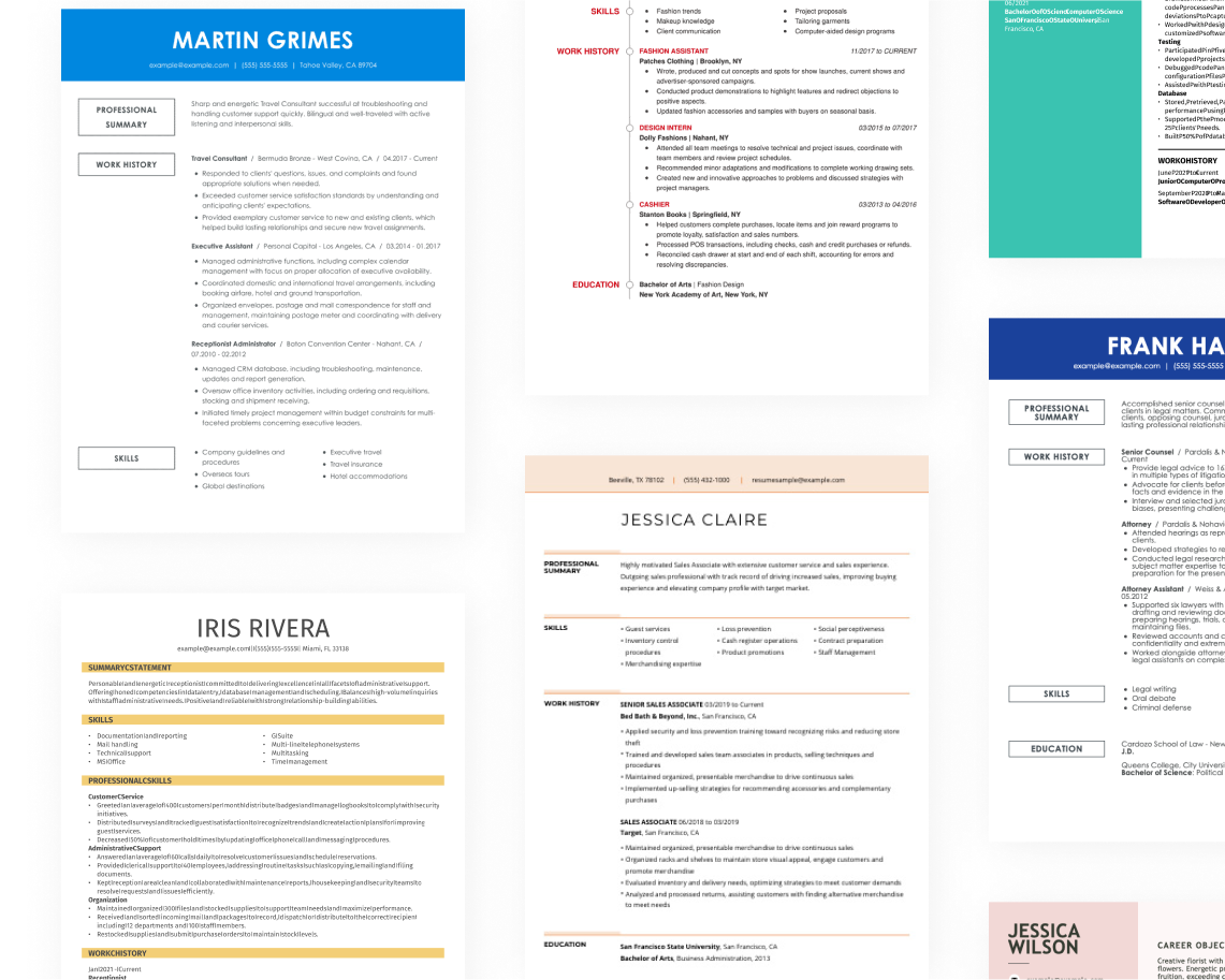
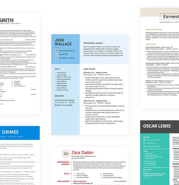
Use our resume examples for inspiration on organization, color, and design—and learn how to effectively summarize your data systems administration skills and experience with confidence.

How to Write a Data Systems Administration Resume
Learning how to write a resume is key to showcasing your unique value in data systems administration rather than just listing your technical skills. By emphasizing your specific accomplishments and experiences, you can create a compelling resume that stands out to employers.
In the upcoming sections, we will guide you through each step of crafting your resume, including resume tips on format, highlighting relevant experience, and effectively presenting your skills to make a strong impression.
Start with your contact info
The header section contains all your contact information, prominently displayed at the top of your resume. Start with your name in a bold, larger font to ensure it stands out. A clean design is key—consider using a simple layout that improves readability without distraction.
Next, include essential contact details such as your email address, phone number, and location; city and state are sufficient. This information is vital for recruiters to reach you quickly and helps applicant tracking systems sort applicants based on their geographical relevance.
Lastly, consider adding links to relevant certifications or training programs, as well as a personal website or online portfolio if applicable. These additional resources can provide further insights into your expertise in data systems administration and help differentiate you from other applicants by showcasing your skills and accomplishments effectively.
Write a strong professional summary
A professional summary serves as your initial introduction on a data systems administration resume and is positioned right beneath your contact details. This section is important as it sets the tone for the rest of your application.
In this brief overview, you should highlight key qualifications, relevant skills, and your enthusiasm for the role. Tailoring this summary to align with the specific job and company can significantly improve its impact.
Consider exploring various resume summary examples to gather ideas on effective content organization and phrasing. These resources can inspire you to craft a compelling summary that stands out to recruiters.
Strong vs weak data systems administration summary
Strong
"Detail-oriented data systems administrator with over seven years of experience in managing complex IT infrastructures. Proven expertise in database management, system optimization, and cybersecurity protocols, resulting in a 30% increase in system efficiency. Skilled in troubleshooting and implementing innovative solutions, holding certifications in CompTIA Security+ and Microsoft Certified: Azure Administrator Associate. Recognized for improving team collaboration and project delivery timelines."
Why this example works: This summary effectively describes the applicant's relevant experience, showcases measurable achievements such as increased efficiency, highlights essential skills like database management and cybersecurity, and incorporates keywords relevant to data systems administration.
Weak
"Data systems administrator seeking a position where I can apply my skills in data management and support organizational needs. I have some experience in IT support and enjoy collaborating with others."
Why this example doesn't work: This professional summary is weak and generic, offering no specific details about the applicant's technical skills, relevant experience, or measurable achievements in data systems administration.

Craft a personal mission statement that highlights your data systems administration expertise while reflecting the organization's commitment to innovation and efficiency. This approach not only showcases your technical skills but also demonstrates your alignment with their goals, improving your overall value as a job seeker.
Share your work history
Listing your work history in reverse chronological order is essential as it showcases your most recent and relevant experience first. This arrangement allows hiring managers to quickly assess your career trajectory and qualifications. It also emphasizes the skills you have developed in your latest roles, making them more visible to potential employers.
When listing your work history, focus on:
- Job title and organization name
- Employment dates (month and year)
- Daily responsibilities (What tasks did you perform regularly?)
- Key achievements (What improvements or successes did you contribute to?)
- Quantifiable results (For example, "increased system uptime by 30%.")
Finally, keep in mind that using action verbs can significantly improve the impact of your job descriptions.
Strong vs weak data systems administration work history
Strong
Data Systems Administrator, Tech Innovations Inc.
2018–2023
- Managed and optimized a cloud-based database system that improved data retrieval speeds by 40%.
- Implemented security protocols that reduced unauthorized access attempts by 75%, ensuring data integrity.
- Led a project team to migrate legacy systems to modern platforms, resulting in a 50% reduction in downtime.
Why this example works: A strong work history highlights specific tasks and achievements, providing clear evidence of your capabilities. It emphasizes quantifiable outcomes and role-specific expertise, showcasing both your technical skills and leadership qualities.
Weak
Data Systems Administrator
Tech Solutions Inc.
- Managed data systems and ensured operations ran smoothly.
- Helped with user access and permissions.
Why this example doesn't work: This work experience entry is ineffective as it lacks specific information about the types of data systems managed, does not include employment dates, and describes vague responsibilities that could apply to any IT role.
Highlight your leadership skills in data systems administration by using specific examples such as "Managed a team of 4 to implement cloud solutions" or "Oversaw system upgrades that improved efficiency by 30%." These instances demonstrate your capability to lead technical projects and drive results effectively.
Highlight your key skills
The skills section of your resume is essential for demonstrating your strengths in data systems administration. Here's a rundown of key skills and their significance in showcasing your expertise:
- Soft skills are personal attributes that demonstrate how you collaborate with others—such as problem-solving, communication, and adaptability. For data systems administration, qualities like attention to detail and teamwork are important because they ensure smooth operations and effective project management within technical environments.
- Hard skills are specific technical competencies acquired through training, education, or hands-on experience. Examples for data systems administration include database management, network configuration, system backups, and troubleshooting software issues.
- Technical skills in data systems administration encompass skill with various tools and technologies essential for managing data infrastructures. Key examples include database management systems like MySQL and Oracle, as well as cloud platforms such as AWS and Microsoft Azure.
For those starting in data systems administration, position your skills section right below your professional summary to highlight your abilities despite limited experience. If you have a robust background, place the skills section after your work history to showcase how your experience reflects those skills.
Top 15 skills for your data systems administration resume
When creating your resume for data systems administration, focus on showcasing skills that align with the demands of the field. It's important to include a mix of technical abilities, like database management and system architecture, as well as soft skills such as problem-solving and teamwork. Highlighting transferable skills is key, as they demonstrate your adaptability in various roles.
Here’s a list of the 15 most popular skills for data systems administrators, based on insights from JobHero users. This selection reflects what employers value most, helping you stand out in your job search by emphasizing relevant qualifications.
Build your education section
The education section of your resume should reflect your level of experience and relevance to the role. For seasoned data systems administrators, work history takes precedence over educational credentials. Consider placing your education at the bottom or removing it entirely if you have substantial experience that demonstrates your expertise.
In contrast, recent graduates entering the field or those shifting to specialized areas should highlight their educational achievements prominently. Position this section near the top of your resume and include relevant coursework, certifications, and projects that showcase your knowledge.
Overall, tailor the education section based on how much directly applicable experience you possess. This strategic approach will help ensure that hiring managers quickly recognize your qualifications and suitability for the role.
20 action verbs to add to your resume
Incorporating action verbs into your resume improves its strength by clearly articulating your experience and creating an engaging narrative. These verbs not only highlight your accomplishments but also draw attention to your skills in a dynamic way.
When applying for data systems administration roles, select action verbs that resonate with the technical skills outlined in job postings. This alignment showcases your relevance to the position and effectively emphasizes your qualifications.
- Configured
- Analyzed
- Streamlined
- Facilitated
- Architected
- Optimized
- Integrated
- Trained
- Promoted
- Oversaw
- Audited
- Delivered
- Sustained
- Guided
- Directed
- Improved
- Executed
- Resolved
- Validated
- Collaborated
Consider additional resume sections
While your core resume provides the most critical information, adding targeted sections can showcase your unique qualifications. These sections help hiring managers quickly identify your skills, experiences, and achievements beyond standard resume sections.
Here are optional sections we tend to see on data systems administration resumes:
- Technical proficiencies: List specific technologies, programming languages, or tools you are skilled in (SQL, Python, cloud services, etc.) to highlight your technical expertise.
- Certifications: Detail relevant certifications such as CompTIA Security+, Cisco Certified Network Associate (CCNA), or Microsoft Certified Solutions Expert (MCSE).
- Project experience: Outline key projects you've managed or contributed to that demonstrate your ability to implement and optimize data systems.
- Performance metrics: Describe improvements in system efficiency, data integrity, or user satisfaction resulting from your initiatives.
- Professional memberships: Include affiliations with organizations like the Association for Computing Machinery (ACM) or Information Systems Security Association (ISSA).
5 Tips for Formatting Your Resume
Proper resume formatting is important for job seekers as it captures the attention of recruiters and improves readability. Using ATS-friendly resume templates can significantly improve your chances of passing through applicant tracking systems, ensuring your qualifications are seen by hiring managers.
1. Watch your line spacing and margins
Proper spacing helps your resume look clean and organized, making it easier for hiring managers to read. Adequate spacing also highlights important information without overwhelming the reader.
- Keep margins between 0.5″ to 1.0″ for a balanced layout.
- Use single spacing between paragraphs and bullet points for clarity.
- Increase space to 1.5″ or double-space between sections to distinguish different parts of your resume.
2. Use a professional font
Choosing the resume font is important as it impacts readability and first impressions. Opt for professional fonts like:
- Helvetica
- Garamond
- Verdana
- Trebuchet MS
- Courier New
- Tahoma
Consider using a slightly bolder or distinct font for your name at the top of your resume to draw attention and add a personal touch.
3. Organize your resume sections
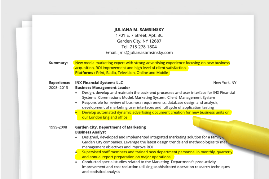
A resume for data systems administration should be organized and clear. Use bullet points to effectively showcase your skills and achievements. Start each bullet with a strong action verb, emphasizing your specific contributions. For instance, "Designed and implemented a new database system that improved data retrieval speeds by 40%," highlights both your role and the impact of your work.
Focusing on measurable accomplishments is important in this field. Quantifying results can help potential employers understand your expertise. For example, "Managed a team that reduced system downtime by 25%, improving overall productivity," illustrates how your actions led to significant improvements.
To ensure compatibility with ATS, use an ATS resume checker before submitting your application. This will help identify any issues with formatting or missing keywords, ensuring that your resume effectively passes through automated filters and reaches hiring managers.
4. Use colors and design
Incorporating color and design elements into your resume can significantly improve its effectiveness and showcase your unique skills in data systems administration. A visually appealing resume captures attention and helps highlight your key qualifications.
Begin by selecting a template that allows for customization. The combination resume format is particularly effective, as it provides a structured layout with a colored section to emphasize your technical skills alongside your work experience.
Next, choose a professional color scheme. Opt for colors that convey trustworthiness and competence, such as dark blues or greens. These shades can be used to accentuate headings or section dividers without overwhelming the content.
It's important to avoid colors that are too bright or distract from the text. Steer clear of flashy colors that can hinder readability, and ensure you don’t use colors associated with competitors in the field. By focusing on a clean design and thoughtful color choices, you can create an effective resume that stands out in the competitive landscape of data systems administration.
If you are involved in data systems administration, your resume should clearly reflect your technical expertise while maintaining clarity. Use clean layouts and professional fonts to ensure readability. Incorporating subtle design elements like borders or icons can improve visual appeal without overwhelming the content.
For instance, if you’re applying to a tech startup, you might choose a more modern look with vibrant colors that convey innovation. In contrast, for a government role, opt for a conservative approach with muted tones and traditional formatting. Remember, your design choices should align with the company culture while effectively showcasing your skills.
5. Keep your resume length to 1-2 pages
Resumes should typically be one page long. This length ensures clarity and makes it easier for recruiters to find key information quickly. Most recruiters spend only a few seconds reviewing each resume, so keeping content concise is essential for making a strong impression.
Focus on your most relevant experiences and skills. Highlight accomplishments that directly relate to the position you’re applying for while avoiding redundancy. If you have extensive experience, particularly in senior roles, consider extending your resume to two pages to adequately showcase your achievements. In academic or research fields, a CV may be more appropriate due to the need for detailed listings of publications and presentations.
Ultimately, prioritize quality over quantity in your resume. Clear formatting and effective language will always resonate more than an overcrowded page.
FAQ
Do I need to include a cover letter with my resume?
Crafting a cover letter is a powerful way to improve your job application, even when it’s not mandatory. It allows you to showcase your unique qualifications and personality, helping you stand out from the crowd. By writing a cover letter, you can provide context that may not be evident in your resume.
If you're looking for inspiration, explore our extensive collection of cover letter examples tailored for various industries. Once you're ready to draft your own, consider using our intuitive Cover Letter Builder for easy guidance through the process.
What is the best resume format?
Choosing the right resume format is essential to effectively showcase your qualifications. The three main formats—chronological, functional, and combination—each serve distinct purposes and cater to different career stages and job seeker profiles.
The chronological format is ideal for those with extensive experience, as it emphasizes a clear work history. In contrast, the functional format highlights skills and education, making it suitable for recent graduates or those changing careers. Lastly, the combination format strikes a balance between experience and skills, which makes it an excellent choice for mid-level professionals or anyone transitioning industries.
How long should my Data Systems Administration resume be?
As a data systems administrator, your resume should ideally be one page long, particularly if you have under 10 years of experience. Employers often sift through numerous resumes quickly, so keeping it concise helps highlight your essential skills and qualifications effectively.
Emphasize relevant technical experience, certifications, and key projects that relate to the specific job you're targeting. It's best to focus on recent roles and strong contributions while excluding outdated technologies or lengthy descriptions of unrelated positions.
Consider extending your resume to two pages only if you are a senior data systems administrator with extensive expertise or specialized skills. In such cases, the additional details about your accomplishments and leadership experiences can justify the extra length.
Should I use a resume template or design my own?
For most job seekers in data systems administration, using a professionally crafted resume template is highly recommended. Templates simplify the writing process and ensure your resume is ATS-friendly, which increases your chances of getting noticed by employers.
However, if you're in a more creative role or have specific design ideas, customizing your own resume can be beneficial. Just make sure it maintains clarity and professionalism to effectively highlight your skills and experience.
Build a custom resume in minutes with our professional templates and expert tips.
Gabriela Hernandez
CPRW, Career WriterGabriela is a Certified Professional Resume Writer (CPRW) and member of the Professional Association of Resume Writers & Career Coaches and has worked in the career industry for more than four years providing comprehensive guidance on resume writing and job search strategies for individuals across diverse career paths. She holds a bachelor's in journalism and is passionate about helping job seekers present their professional story effectively through well-crafted resumes and cover letters that demonstrate their value, skills, and experience to potential employers. Some of her work has been featured on JobHero’s resume examples career center.
More Resources


By Natalia Merced | CPRW, Career Writer

By Gabriela Barcenas | CPRW, Career Writer

By Natalia Merced | CPRW, Career Writer
By Gabriela Barcenas | CPRW, Career Writer